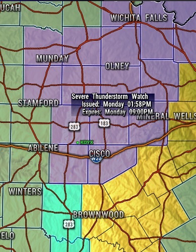
Severe Thunderstorm Watch for portions of Southwest and South-central Oklahoma Northwest Texas
Effective this Monday afternoon and evening from 200 PM until 900 PM CDT.
In the Watch: Callahan, Eastland, Knox, Shackelford, Childress, Cottle, Hardeman, Wichita, Baylor, Clay, Haskell, Montague, Stephens, Wilbarger, Collinsworth, Foard, Jack, Palo Pinto, Throckmorton, Young
Primary threats include… Scattered large hail likely with isolated very large hail events to 2 inches in diameter possible Scattered damaging wind gusts to 70 mph possible. A tornado or two possible.
SUMMARY…Bands of storms will continue to develop and intensify through mid/late afternoon across the Low Rolling Plains of northwest Texas, and subsequently into southwest/south-central Oklahoma by evening. Isolated large hail and damaging winds are expected to be the primary hazards. The severe thunderstorm watch area is approximately along and 75 statute miles east and west of a line from 25 miles north northwest of Fort Sill OK to 25 miles east southeast of Abilene TX.

