
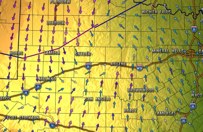
As of mid-morning Thursday, a cold front was situated in a southwest to northeast line from near the Snyder area toward Wichita Falls. (shown in photo)
According to KOXE Meteorologist Randy Turner, we should enjoy the nice, warm weather today because Friday will be much colder and light rain with a little sleet or snow is possible.
“I’m expecting light precipitation, light rain or even drizzle, to start early Friday morning. Temperatures will be cold enough though that light sleet or snow could mix in through Friday morning into early afternoon. As of now, I don’t anticipate significant accumulations or widespread travel issues. This is not expected to be a huge winter event for us, but keep an eye on bridges and overpasses for icy slick spots Friday morning,” Turner said. Travel conditions will get worse going northward from the Brownwood area, especially along the Red River counties and into Oklahoma.
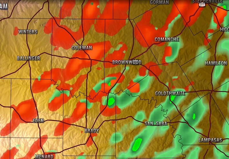
The forecast model below is what the weather is projected to look like at 9:00 am Friday. The green area is rain, the red represents where wintry mix could be falling. Icy patches are possible, mainly on bridges and overpasses.
The low is forecast to be 30-32 degrees by early Friday morning. The high Friday is forecast to be 34-36 in the Brown County/Central Texas area, Turner said. The main concern for any icy bridges or overpasses would be from sunrise through late morning. The precipitation moves east Friday afternoon and skies clear going into Friday night.
“The coldest night is Friday night when the temperature is forecast to drop to near 20 degrees by sunrise Saturday morning,” Turner said.
Temperatures are then expected to improve to the middle 50’s Saturday under sunny skies and the middle 60’s under sunny skies on Sunday.
Strong and gusty south wind is likely Sunday afternoon into Monday, increasing our wildfire danger.