Significant Winter Storm to bring a chance for snow and severe
weather to West Central Texas this week…
A potent upper level storm system will move across the area this
week. Severe storms are possible Tuesday Night as the system
approaches, with snow then possible Wednesday into Thursday.
What you need to know
- The main threat this week will be the chance for snow, likely
starting as early as late Wednesday afternoon across the western
Big Country and Concho Valley. The chance for snow will increase
across all of West Central Texas Wednesday Night and Thursday
morning. Its still a little too early to forecast exact snow
amounts, but there is a potential for enough snow accumulation to
produce hazardous driving conditions over at least a portion of
West Central Texas.
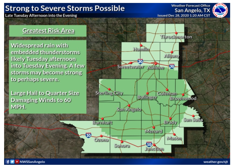
- There is also a potential for strong to severe thunderstorms on
Tuesday Night across most of the area. Pockets of large hail up to
the size of a quarter and damaging winds are possible as these
storms sweep across the area.
- The forecast will become more certain with both the snow and
severe weather potential as we get into later Monday and Tuesday.
Watches and warnings may be required. Motorists who are planning
on traveling across the area should pay special attention and plan
on adjusting your travel based on the latest forecast.

