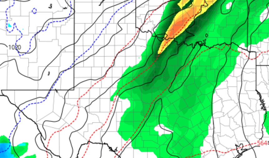
From KOXE Meteorologist Randy Turner – Sunday Morning Update 12/27/20
New weather data coming in on Sunday morning indicates a good chance for rain and, perhaps, a little snow mixed in when the system exits Wednesday night into early Thursday morning.
The scenario is a dynamic upper level low will approach Texas from the southwestern U.S. by Tuesday morning. There is a slight chance for showers Monday night and Tuesday, but it is Tuesday night, Wednesday and Wednesday night when most of the precipitation will occur. A few thunderstorms may also occur. The precipitation is expected to be rain through the day Wednesday, but, as colder air moves in Wednesday night, and what’s left of the low passes over, forecast models are suggesting that some snow could mix with rain Wednesday night into early Thursday morning. Temperatures will be plenty cold enough at ground level to freeze any water left on roads Wednesday night and Thursday morning.
As far as rain amounts, data is now suggesting somewhere between a half inch and one inch in the KOXE listening area, an improvement over my update posted Saturday.
As usual, check our daily video forecasts on KOXE.com and the KOXE App starting Monday and stay up-to-date on a weather system which will impact much of the nation this week with severe weather and winter weather.

