
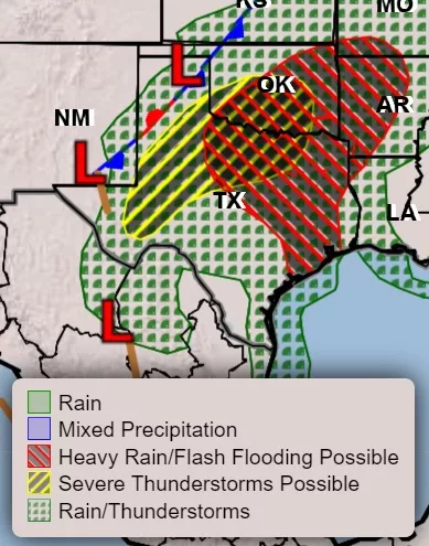
Much of Texas is going to get drenched today and Thursday but some severe storms are also likely.
According to KOXE Meteorologist Randy Turner, strong to severe thunderstorms will be possible this evening (Wed) and through the overnight hours, then continue until about noon on Thursday morning here in Brown and surrounding counties.
The main hazards will be large hail and damaging winds but an isolated tornado is also possible.
In addition, heavy rainfall will be possible for much of the area tonight into Thursday morning, which may result in localized flooding.
“We should see two rounds of stormy weather. The first round will come this evening between 6:00 pm and midnight. The second round comes when a cold front moves into the area between midnight and 3:00 am Thursday. Widespread showers and storms are expected along the cold front which will carry through your morning commute on Thursday morning and last until about noon on Thursday,” Turner said.
A few light rain showers could linger Thursday afternoon.
After a high temperature near 90 today (Wed), the high on Thursday is forecast to be near 75 with a gusty north wind. The low Thursday night is forecast to be near 60 followed by a mostly sunny day on Friday with a high near 80. The low Friday night is forecast to be in the low to middle 50’s followed by a high on Saturday in the low 70’s under partly cloudy skies. Saturday night lows are forecast to reach the upper 40’s followed by a sunny Sunday with a high near 78.