
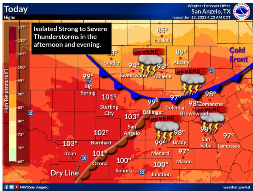
From the San Angelo National Weather Service Office early on Monday morning, June 12: A weak cold front will move south through the Big Country this afternoon, likely moving along a Sterling City…Robert Lee…Winters…Cross Plains line around 7 PM this evening. A dryline may extend from Ozona to San Angelo to a triple point along the dryline/front at Ballinger or Coleman. (a triple point is often a focus for storm development)
The only problem is in storm initiation. Coverage may be low, but if storms develop, they will likely become severe. The Storm Prediction Center outlook mentions the potential for very large to giant hail of 3+inches. There is also the potential for a tornado along the boundary/cold front. There is an enhanced risk of severe storms from Baird and Cross Plains to Brownwood. Temperatures this afternoon are expected to reach close to 100 degrees.
As usual, have a way to receive weather warnings mid to late afternoon and have a safe place to go to in the event severe weather affects your area.