
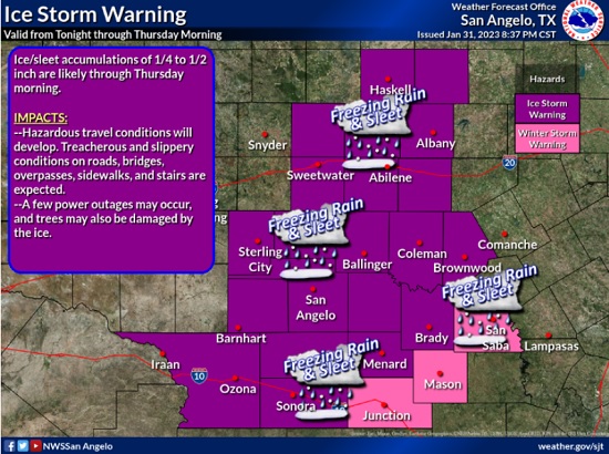
The National Weather Service has issued an Ice Storm Warning until 6:00 am Thursday for Brown and area counties.
WHAT… Several rounds of wintry precipitation are expected through Wednesday night. The precipitation will be mainly in the form of freezing rain and sleet. The precipitation could be moderate to heavy at times. Total ice accumulations of a quarter to one half of an inch are possible, with localized higher amounts.
IMPACTS… Accumulation of ice on roadways, bridges and overpasses will cause hazardous travel conditions from today through Wednesday night. A few power outages and damage to trees will also be possible due to the ice accumulations.
ADDITIONAL DETAILS… This will be a prolonged event with temperatures below freezing and several rounds of freezing precipitation. Travel conditions will remain very hazardous and will likely only get worse on Wednesday.
PRECAUTIONARY/PREPAREDNESS ACTIONS…
Travel is strongly discouraged. If you must travel, keep an extra flashlight, food and water in your vehicle in case of an emergency. Prepare for possible power outages.