
A dynamic weather system will impact Texas weather on Monday and an outbreak of strong to severe storms is likely over a large area of the Lone Star State.
According to KOXE Meteorologist Randy Turner, an upper level low pressure system coming in from the southwestern U.S. will roll into New Mexico early Monday morning. This will cause an increase in Gulf of Mexico moisture to overspread Central, East and North Texas.
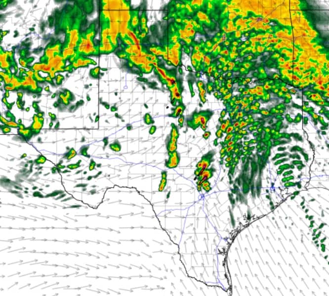
“Here locally, we can expect scattered very light rain showers to begin around sunrise Monday morning. Closer to noon I expect a few thunderstorms should begin to form in our area. Forecast models suggest afternoon storms may persist through early evening on Monday. The Storm Prediction Center has placed the KOXE listening area in a Slight Risk (level 2 on a scale of 5) for severe storms Monday afternoon capable of producing large hail and damaging wind,” Turner said.
Farther to the east, I-35 from DFW to Waco to Austin, storms may reach their highest intensity Monday afternoon and evening. Tornadoes are also a threat Monday but mainly from the I-35 corridor to I-45 in East and Southeast Texas.
“We need to stay weather aware Monday. We may have strong storms locally but we desperately need the rain. And we only have this one day of rain in the forecast for the next week. The chance for rain is 80% Monday. Forecast models are currently estimating rain totals from a half inch to three-quarters of an inch will be possible Monday. Let’s hope it’s more,” Turner said.
He added that behind the storms on Monday night will come strong and gusty wind from the Northwest at speeds of 20 to 30 mph which will continue through Tuesday into Tuesday night. Expect highs on Monday in the 70’s but highs on Tuesday in the low 60’s.
(IN THE PHOTO: A high resolution forecast model projecting what the radar may look like Monday afternoon in Texas.)